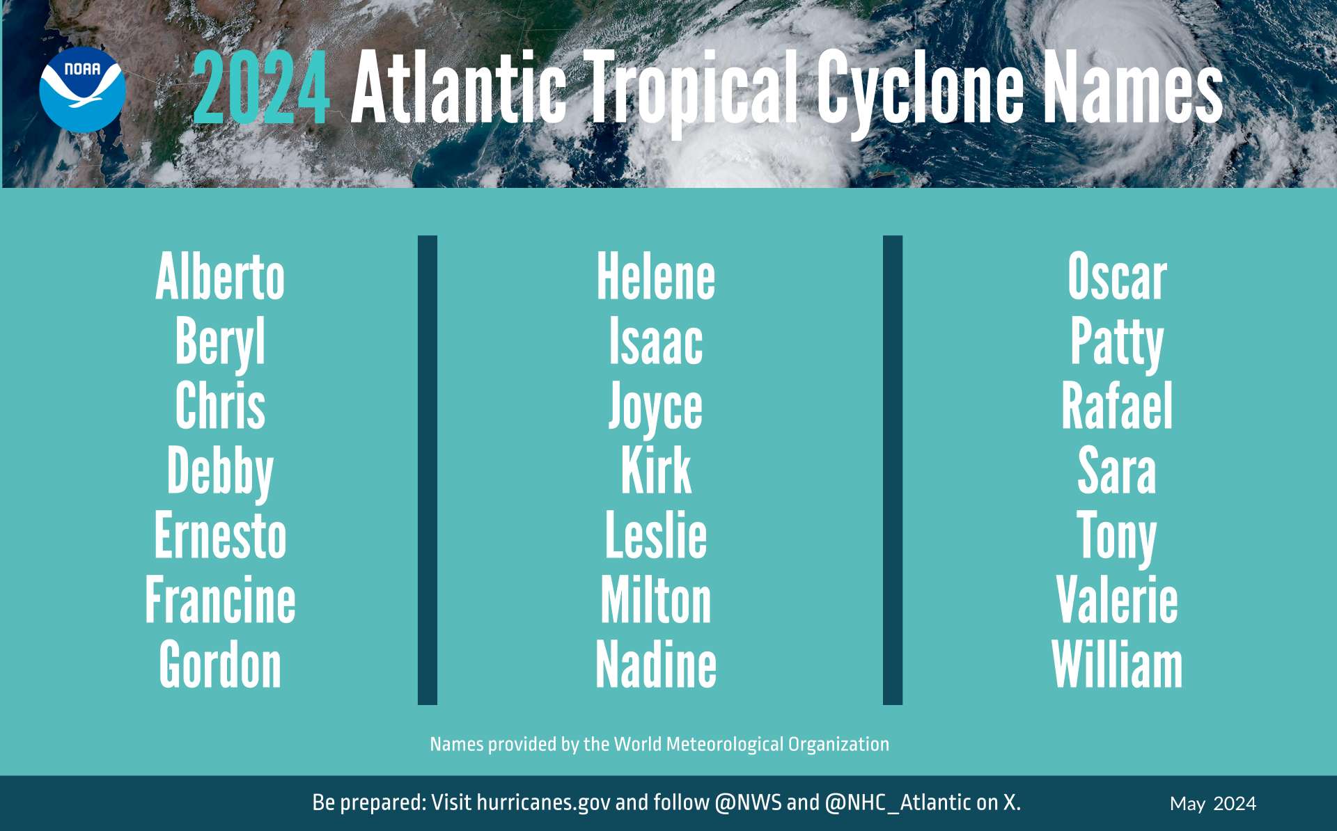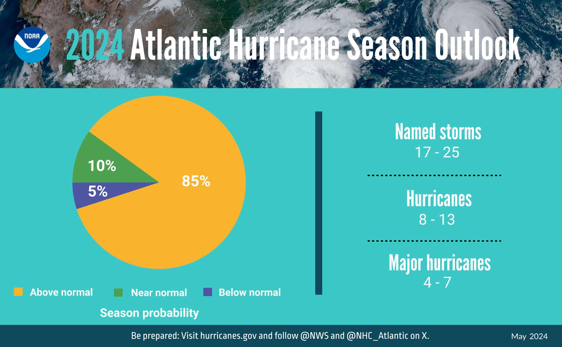

Which 2024 tropical cyclone names will be used for hurricanes? That is, many or all of these names will be used for tropical cyclones, which of those will become hurricanes?
This is specifically about the northern Atlantic hurricane season.
@Gabrielle
Patty never became a hurricane,
Rafael has just become a hurricane https://www.nhc.noaa.gov/text/refresh/MIATCUAT3+shtml/060021.shtml
so these can resolve.
Nadine has dissipated; Final advisory. I believe this can resolve now.
https://www.nhc.noaa.gov/text/refresh/MIATCDAT5+shtml/201442.shtml
https://www.nhc.noaa.gov/text/refresh/MIATCMAT5+shtml/201439.shtml
After Nadine dissipates over southern Mexico, its remnants are
expected to move into the eastern Pacific.  The combination of the
remnants of Nadine and influences from the Gulf of Tehuantepec gap
wind event are forecast to result in formation of a new low pressure
system off the coast of southwestern Mexico in a couple of days.
Additional development is expected after that time, and a tropical
depression is likely to form during the early to middle part of next
week while the system moves westward at about 15 mph away from the
coast of Mexico.
If Nadine gets renamed in Pacific and intensifies to hurricane does Nadine resolve no?
What if not renamed in Pacific and intensifies to hurricane?
D'oh sorry should read answer commented 2 hours ago.
@ChristopherRandles I give it 15% chance of the remnants becoming a hurricane from EPS/00Z, but since NHC is predicting it will be renamed as such its even less.
I'm not worrying and even bet it down as such.
@ChristopherRandles Just to confirm, the name is the critical part for this market. If there is a Hurricane Nadine in the 2024 season, even if it’s located in the Pacific, that option will resolve YES, but “Hurricane X, made from the remnants of TS Nadine” will resolve NO.
I have to revise what I said earlier: based on EPS/00Z ensemble alone, I think its remnants have >80% now of helping fuel the next hurricane in the EP. Only 6% of its members have continuity into the EP though.
The 5AM NHC discussion seems to give good reason it will lose its tropical cyclone status though:
The depression is moving toward the west-southwest, or 255/12 kt.
The forecast shows the system accelerating slightly and bending a
bit more toward the southwest this morning.  This motion would bring
Nadine toward terrain of about 8,000 to 9,000 ft above sea level in
about 6 hours.  Terrain of that height is likely to break apart
Nadine's low-level circulation, which should cause the cyclone to
dissipate later this morning.  A remnant low position is provided
at 12 hours for continuity, but Nadine will likely have dissipated
by that time. @ScottSupak I have no idea about the rules for tropical storms in general, but this specific market is able to resolve YES if the storm continues over to the Pacific, keeps its name, and becomes a hurricane named that.
@Gabrielle From what I can tell, if it keeps a certain amount of circulation it will be considered the same storm and will keep the name, but I have no idea what their criteria are for determining that.
I forgot to check but the TWO for the EP describes the situation succinctly, and forecasts it explicitly as a new system:
South of Southwestern Mexico:
After Nadine dissipates over southern Mexico, its remnants are
expected to move into the eastern Pacific by late today. The
combination of the remnants of Nadine and influences from a Gulf of
Tehuantepec gap wind event are forecast to result in the formation
of a new low pressure system off the coast of southern Mexico in a
day or so. Additional development is expected after that time, and
a tropical depression is expected to form during the early to middle
part of this week while the system moves westward at about 15 mph
away from the coast of Mexico.
* Formation chance through 48 hours...medium...60 percent.
* Formation chance through 7 days...high...90 percent.
$$
Forecaster Landsea
@ChristopherRandles I usually wait until the NHC's website states it as a hurricane, but in this case it seems certain enough that I'll resolve it now.
Very unusual season, explained here: https://www.wsj.com/us-news/climate-environment/why-this-hurricane-season-has-defied-forecastsso-far-82ed6855?st=0b5c0o5eiou95bw&reflink=desktopwebshare_permalink
Also this market that is related to the season making it to William:
Getting in on early for Chris assuming Invest96L assumes its name and not Invest94L or some other future storm, NHC predicting genesis at 70%. Also, GFS/00Z from this morning showing it reaching 80kt on July 4/06Z.
